
The potential for strong to severe thunderstorms is increasing across parts of Central Illinois on Tuesday, August 11th, with damaging winds being the primary concern.
Forecasters say storms could organize into a complex of windy thunderstorms and move southeast across the area. The storms are expected to develop fairly quickly late Tuesday morning as a remnant area of energy moves into Illinois from Iowa.
The main timeframe being watched is from approximately 10 AM through 7 PM Tuesday, although forecasters say the exact timing and location of the strongest storms will be refined as the event gets closer.
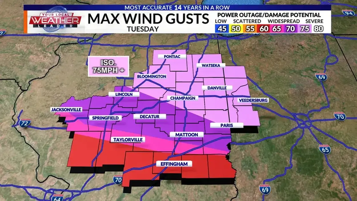
The greatest potential for strong storms currently appears to be along and north of Interstate 74. Storms in that area could produce wind gusts of 75 miles per hour or higher.
Residents should remain weather aware throughout the day and have multiple ways to receive weather warnings. If a severe thunderstorm warning is issued for your location, move indoors and stay away from windows.
High winds can also create additional hazards by knocking down tree limbs and power lines and blowing around unsecured outdoor objects. If possible, bring in or secure items such as patio furniture, decorations, trash cans and other loose objects before storms arrive.
Residents are encouraged to monitor the latest forecasts Tuesday and be prepared to take shelter quickly if severe weather develops.
Pictured below is an image sourced from WCIA Meteorologist, Jacob Dickey, showing the effected area:

To stay up to date live and in the moment during severe weather in Christian County, tune your radio dial to 96.1 WTIM, Your Only Local News Radio. Stay up to date with local weather, news, sports, and much more at taylorvilledailynews.com.