

A round of potentially strong to severe thunderstorms could impact much of west-central Illinois Wednesday afternoon and evening.
The National Weather Service says the area is under a Marginal Risk, or Level 1 out of 5, for severe weather. While widespread severe storms are not expected, a few storms could become strong enough to produce damaging wind gusts over 60 miles per hour, hail larger than one inch in diameter, and even an isolated tornado. Heavy downpours may also lead to localized flooding in some areas.
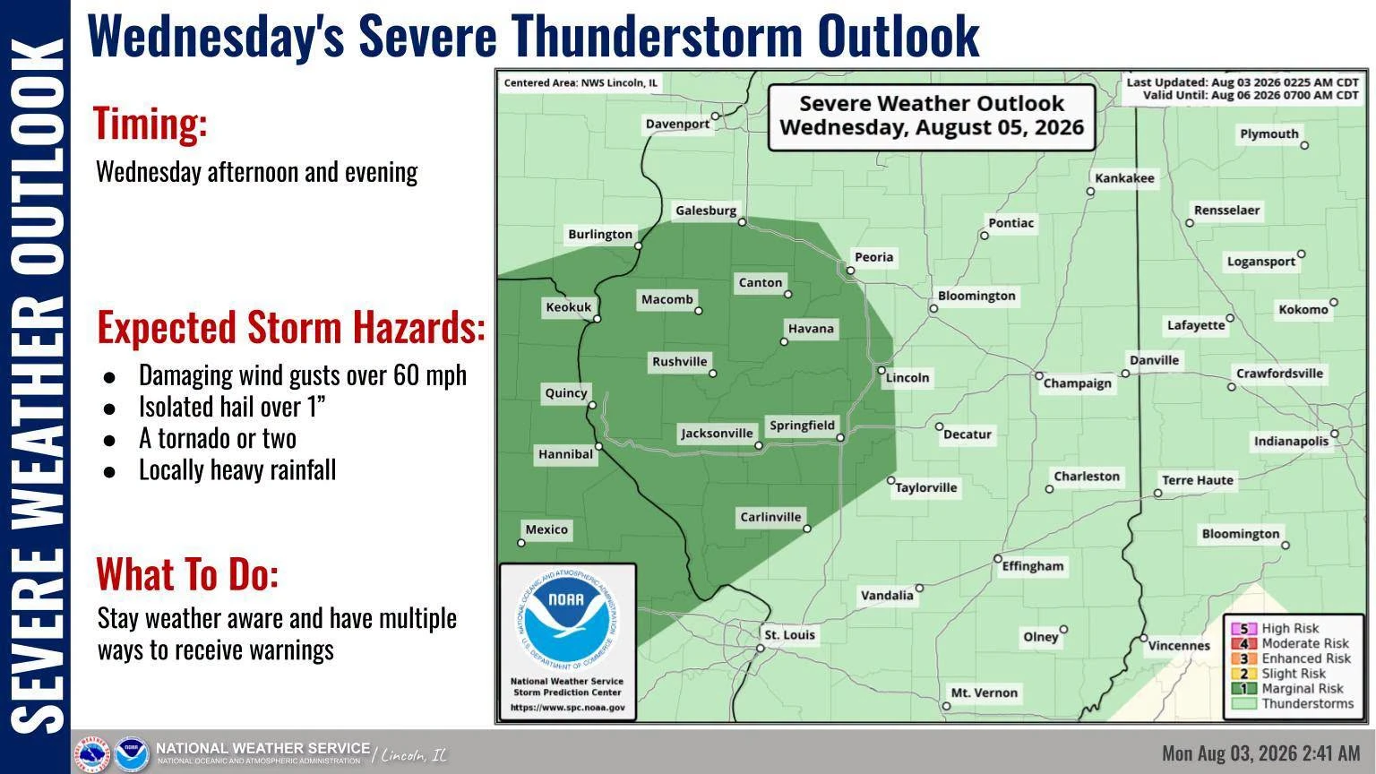
Forecasters say not everyone will experience severe weather, but conditions could change quickly if storms develop. Residents are encouraged to stay weather aware throughout Wednesday afternoon and evening and have multiple ways to receive watches and warnings, including weather radios, smartphone alerts, or local media.
If a Severe Thunderstorm Warning or Tornado Warning is issued for your area, move indoors immediately and stay away from windows until the storm passes. Drivers should also use caution, as heavy rain and strong winds can quickly create hazardous travel conditions. Be sure to always keep a charged smartphone, battery backups, and if possible, a battery powered FM radio and keep it tuned to WTIM 96.1 FM, Your Only Local News Radio, to stay up to date during severe storms.
We'll continue to monitor the latest forecast and provide updates if conditions change at taylorvilledailynews.com.