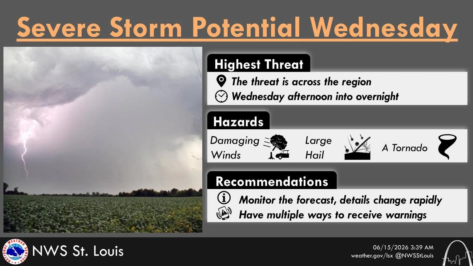
The Christian County Emergency Management Agency (CCEMA) alerted the county of another round of severe weather in the forecast. The severe storms are expected to hit on Wednesday, June 17th, between the afternoon and late evening. The National Weather Service says that there is a potential for strong winds, damaging hail, and even strong tornado activity.
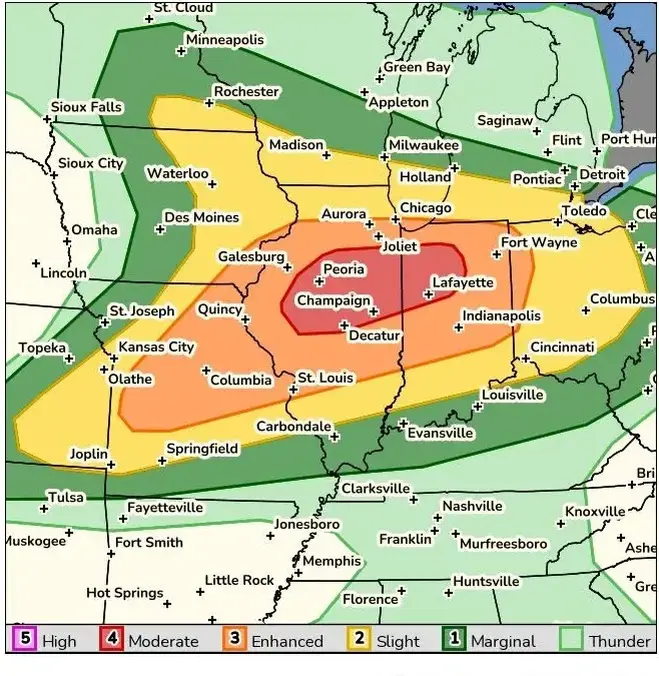
The risk of this potential severe weather has been increasing since last weekend. Central Illinois towns such as Taylorville, Assumption, and Moweaqua are at a level 3 risk, whereas towns and cities north of Taylorville, such as Springfield, Lincoln, and Decatur, have been upgraded to a 4 out of 5 risk.
The National Weather Service has also stated that the highest risk for severe weather will be along and northwest of Interstate 70 in Illinois. Residents in this area should stay weather aware and make sure that they are prepared with a severe weather plan, and ensure they have their emergency kit with a flashlight, batteries, radio, phone chargers or portable power bank, and blankets prepared in the event the storms get too severe.
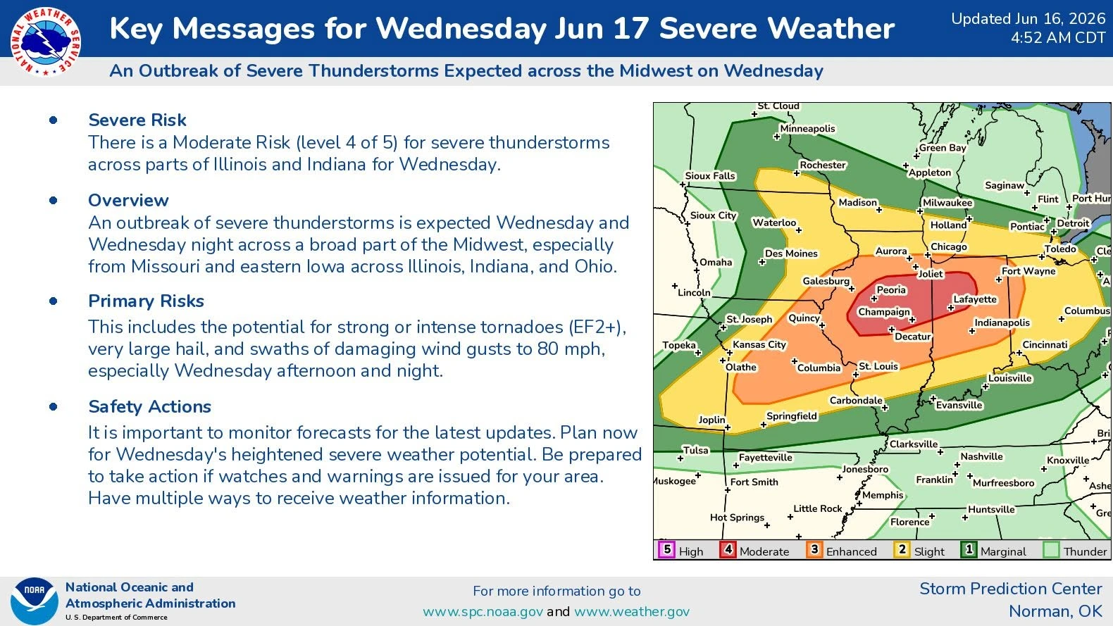
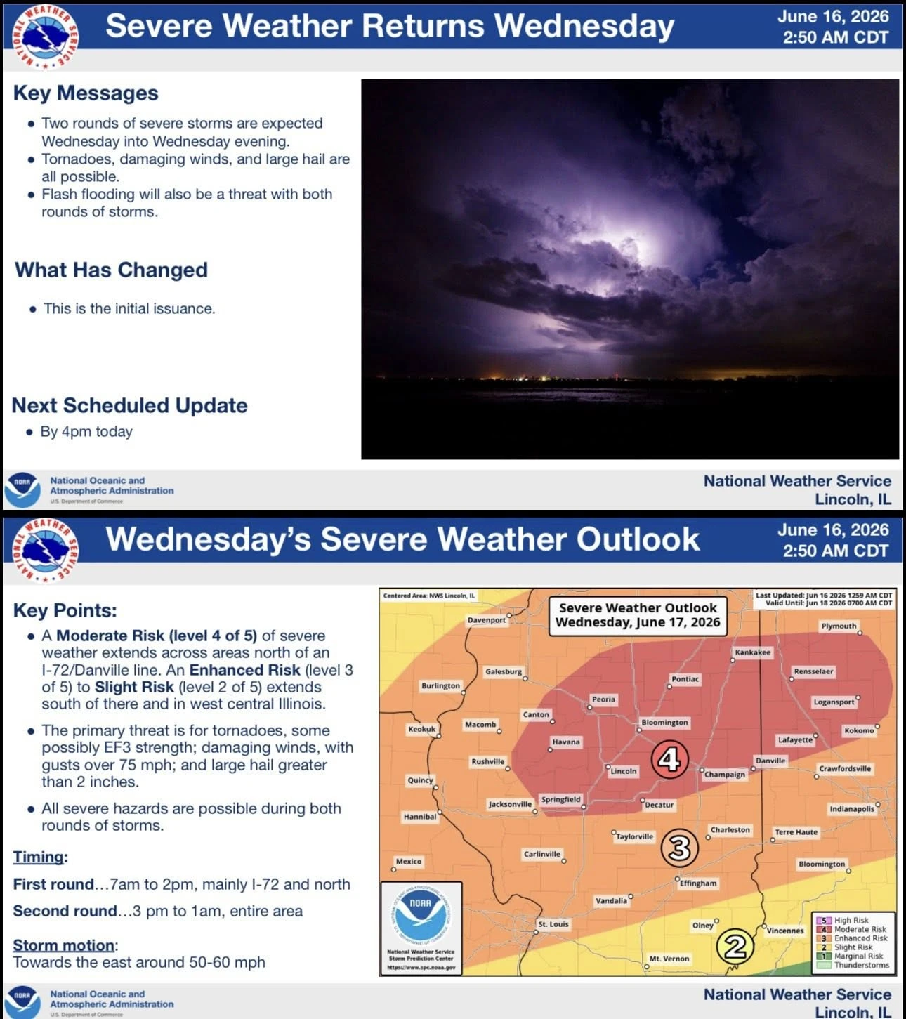
The greatest potential risk of this storm system is large hail, heavy swaths of wind, and strong tornadoes.
The tornadoes could be as strong as an EF2 or EF3. Weather experts urge residents to stay alert and be prepared to take precautionary actions.
There is also a possibility of rain-wrapped tornadoes. A rain-wrapped tornado occurs when heavy rain surrounds or completely hides a tornado, making it extremely difficult to see. Unlike traditional tornadoes that may be visible from a distance, a rain-wrapped tornado can approach without much warning, increasing the danger for those who rely on visual confirmation. These storms can produce the same destructive winds and damage as any other tornado, including downed trees, power lines, structural damage, and dangerous flying debris. Residents are urged to never attempt to see or photograph a tornado and to take immediate shelter when a tornado warning is issued, even if a funnel cloud is not visible.
Another safety concern would be driving during these storms. If you are driving when a tornado warning is issued, weather officials say the safest option is to avoid being on the road whenever possible and seek sturdy shelter before the storm arrives. If a tornado is nearby and you are unable to reach a safe building, do not try to outrun the storm or stop under a bridge or overpass, as those areas can become extremely dangerous due to high winds and flying debris.
If possible, pull over, park safely away from traffic, and get inside a sturdy building. If no shelter is available and you are caught in the immediate path of a tornado, experts recommend staying buckled inside your vehicle, keeping your head below the window line, and protecting yourself from debris. Always remember, a vehicle offers little protection from a tornado, so the best safety measure is to plan ahead and avoid driving during dangerous storms.
Stay tuned to 96.1 WTIM, Your Only Local News Radio, and taylorvilledailynews.com to stay up to date on breaking news and weather alerts.